
REVIEW · MOUNTAIN & SUMMIT HIKES
Munnar mountain hiking (Full day)
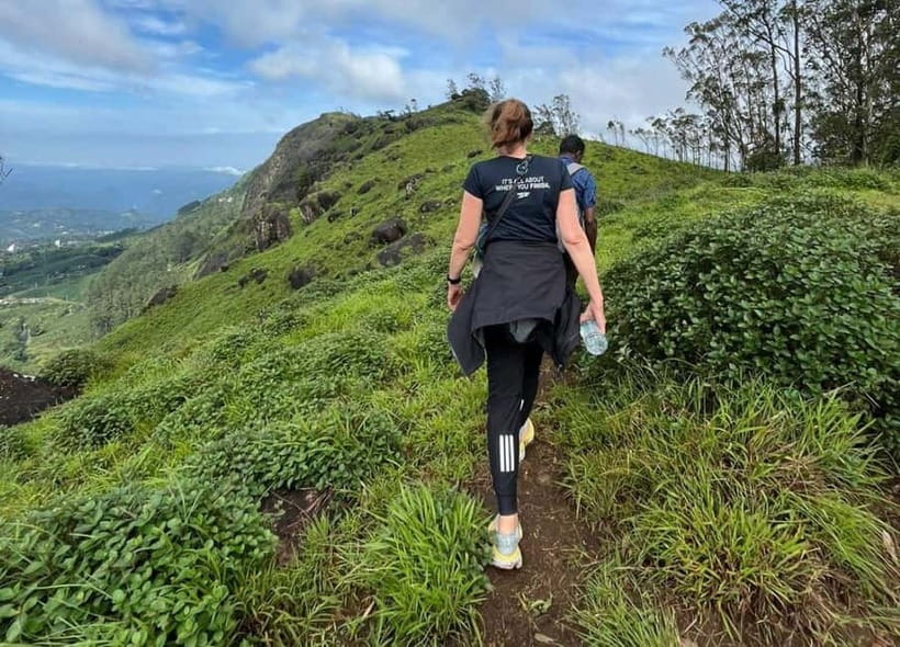
Munnar’s best walking experience may be the long climb from tea country into cardamom and shola forest, where trimmed rows of tea bushes give way to wilder ground and broad mountain views. You start around 1,420 meters and work toward a high point near 2,000 meters, with the chance of spotting Malabar squirrels, black monkeys, birds, and perhaps a distant elephant.
I like the strong local knowledge offered by guides such as Raja, Ramesh, and Rajain, especially when they explain tea picking, useful plants, and village life. I also like the practical setup: lunch, snacks, tea, and plenty of water are provided. The catch is the distance. This is a long day on foot, and the actual walk can range from about 12 to 18 kilometers depending on the route.
Key points at a glance
- Tea to forest in one day: Walk from Munnar’s working tea plantations into cardamom groves and shola woods.
- High point near 2,000 meters: The route begins at roughly 1,420 meters and climbs through cool mountain air.
- Guides make the difference: Raja, Ramesh, and Rajain are praised for explaining tea, plants, wildlife, and local life.
- Food and water are included: You receive mineral water, packed food, snacks, tea, and refreshments along the way.
- Moderate but lengthy effort: The climb is not described as technical, yet 14 to 18 kilometers requires decent stamina.
- Wildlife is possible, not promised: You might see birds, Malabar squirrels, black monkeys, or elephants, sometimes from a safe distance.
What this Munnar hike is really like
This is a full-day mountain walk rather than a quick viewpoint outing. You meet at the Munnar Info point, with pickup available from the Munnar town area, then begin a route through the hills around Pothamedu and Lekshmi Hills.
The advertised duration is seven hours. The walking portion may be closer to six hours, with the rest taken up by breaks, food, and time spent looking at plants, views, and tea work. The route length is given as 14 to 18 kilometers, though one reported outing covered about 12 kilometers with less than 500 meters of ascent. That difference matters, so ask about the planned route and expected distance before setting out.
The path is not presented as a technical mountain trail. You will not need climbing equipment, but you should be ready for uphill sections, uneven ground, and a long day outside. A moderate level of fitness should suit the easier version of the walk. If you rarely hike, the distance may be more tiring than the height gain.
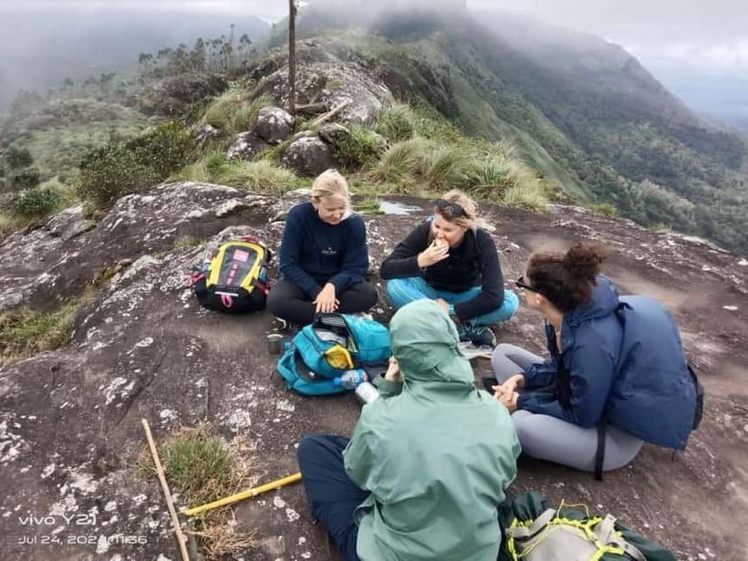
The pace appears to be sensible. Guides generally include regular stops, which gives you time to catch your breath and listen. That also makes this more than a silent march uphill. You get a chance to ask why tea is grown at these heights, how plants are used, and how the people who work in the hills live.
More Mountain Hikes in India:
- Mountain Hiking in Munnar (half day) By Munnar Info
★ 5.0 · 390 reviews - Private One Day Hiking Trip in Manali, Scenic Mountain Trail in Manali
★ 5.0 · 13 reviews - Mountain hiking in Munnar (Half day )
★ 5.0 · 3 reviews
Starting among Munnar’s tea plantations
The opening stretch takes you through the tea plantations that have made Munnar famous. The neatly clipped bushes run across the hills in repeating rows, creating a striking contrast with the rougher forest ahead.
This is where your guide’s explanation adds real value. Raja, Ramesh, and Rajain have been praised for discussing tea production, harvesting, different kinds of tea, and the lives of plantation workers. You may also learn how the cultivated plants differ from the native species growing nearby.
The cool air is a welcome change from the heat found in many parts of Kerala. At this elevation, the walk can feel fresh, but do not mistake cool weather for weak sun. Bring sunscreen, and keep it handy during exposed sections.
Some outings begin with a short snack or coffee stop before the main walking starts. The exact arrangement can vary, but the day includes planned breaks and food along the route. You do not need to load your backpack with a full day’s supply. Water and packed food are included, though carrying a small personal bag for sunscreen and an extra layer still makes sense.
The tea fields are also a good place to settle into the pace. You can stop to photograph the rows, look across the hills, and notice the contrast between the orderly plantations and the forest beyond. If your main goal is classic Munnar scenery, this first part delivers it without requiring a summit push.
Climbing toward the 2,000-meter high point
From the tea plantations, the route heads higher. The starting elevation is about 1,420 meters, and the highest point is listed near 2,000 meters above sea level. That climb provides the main physical challenge of the day.
You should expect some uphill stretches, but the walk is not consistently steep. One account describes only one or two longer uphill sections, with plenty of pauses. Another confirms that the full route can cover 14 to 16 kilometers, so the length may be more important than the steepness.
The reward is a wider view over Munnar’s mountain country. The higher sections offer a different feeling from the plantation paths below. Tea fields sit among folds of hills, while darker forest patches mark the less cultivated areas.
This is a good point to judge your energy. If your legs are already tired, the remaining route still includes forest walking and a descent. Tell the guide if you need a slower pace or another rest. The experience is guided, not a race, and the schedule allows for breaks.
The word hike can mean different things to different people. Here, it means a serious sightseeing walk with a climb, not a difficult mountaineering trip. People with moderate fitness should generally manage it, while anyone with a low level of fitness may find the distance uncomfortable.
Cardamom forests and the scent of Kerala
Beyond the tea fields, the route enters cardamom-growing country. Cardamom is one of Kerala’s best-known spices, and the forest has a different character from the open plantation slopes.
The air may carry the spice’s clean, warm scent, while the shade makes the walking more comfortable. Your guide can point out the plants and explain their uses, including some traditional medicinal plants. This is one of the strongest reasons to choose a guided walk rather than simply following a path on your own.
The forest also changes what you notice. In the tea fields, the view is broad and organized. Among the cardamom plants, you pay more attention to smell, texture, birdsong, and small changes in the undergrowth.
The route passes through shola woods, a distinctive high-elevation forest type associated with the Western Ghats. Ferns, mosses, and thick undergrowth cover parts of the forest floor. The canopy creates a quieter, more enclosed setting, and afternoon light can filter through the trees on the way down.
Do not expect every section to deliver a dramatic animal sighting. Wildlife is present, but it moves on its own schedule. The possible sightings include Malabar squirrels, black monkeys, and birds, with wild elephants sometimes visible in the distance. One outing had an elephant close enough that the group had to wait for it to move away. That is memorable, but it also shows why you should follow the guide’s instructions and keep a respectful distance.
A few more hikes around India worth a look
- Full day in hiking in Munnar (By Munnar Info)
★ 5.0 · 176 reviews - From Marrakech: Atlas Mountains Full-Day Hiking Trip w Lunch
★ 4.8 · 7,417 reviews - From Sofia: The Seven Rila Lakes Full-Day Hiking Tour
★ 4.7 · 923 reviews - Halong Bay Full Day with Kayaking, Hiking viewpoint, Cave – Deluxe To Luxury
★ 5.0 · 884 reviews
Wildlife, birds, and useful plants
The forest is especially appealing if you enjoy small discoveries rather than a checklist of animals. The guide may identify plants used in local medicine, explain how cardamom grows, or point out a bird moving through the trees.
The area is suited to birdwatching, with endemic species found in the Western Ghats. You should bring patience and keep your eyes moving. Birds may appear briefly, and dense foliage can make them hard to photograph.
Malabar squirrels and black monkeys are also possible sightings. An elephant encounter is less predictable and should never be treated as the main promise of the walk. The safest and most rewarding approach is to appreciate the forest itself, then treat wildlife as a bonus.
Ramesh and Raja are particularly useful if you want more than pretty views. Their explanations cover local plants, tea, animals, and the environment. A guide who notices the smaller details can turn an ordinary stretch of trail into a lesson in how the hills work.
One practical note: there have been comments about guides taking phone calls during the walk. Most of the feedback about the guiding is very strong, but if quiet time in nature matters to you, it is reasonable to ask for phones to be kept quiet except when needed.
Lunch, tea, and the value of the $24 price
At about $24 per person, this is a strong value if you want a full day outdoors and do not want to arrange food, water, route finding, and a guide separately.
The price includes a trained English-speaking guide, packed food, mineral water, and entry fees. The food may include homemade snacks, tea, coffee, and a local-style lunch. That makes a difference on a long walk. You can save space and weight in your pack, then stop properly instead of eating a rushed snack while walking.
The meal is not just a practical refill. Local food gives the day a stronger connection to Kerala than a standard packaged lunch would. Specific menus are not provided, so do not book this expecting a particular dish or dietary arrangement unless you confirm it in advance.
Transportation is the main extra consideration. Pickup is available from the Munnar town area, but private transportation for pickup and drop-off is not included as a separate tour feature. The meeting point is Munnar Info. Clarify the exact pickup arrangement when booking, especially if you are staying outside central Munnar.
The booking terms are flexible: you can cancel up to 24 hours before the activity for a full refund, and you can reserve now and pay later. These terms are useful if rain or changing plans might affect your schedule, though the activity’s actual operation depends on conditions and availability.
The afternoon descent to Old Munnar
The return walk is scheduled for roughly 3 to 5 pm and leads back toward Old Munnar. By then, the legs will have done most of their work, but the descent can still be tiring, especially on uneven ground.
The afternoon light is part of the appeal. The shola forest can look different on the way down, with sunlight filtering through the trees and longer shadows across the path. The route gives you one more chance to see the shift from forest to plantation before the day ends.
Do not rush this section. A careful downhill pace is easier on tired knees, and it gives you time to enjoy the final views. The day concludes at the Munnar Info meeting point.
The timing works well for someone who wants to reserve an evening in Munnar. Still, allow a little flexibility. A wildlife stop, longer lunch, or slower pace can change the exact return time.
How hard is the walk?
The most accurate description is moderate and long. The route does not appear to involve technical climbing, and several outings were comfortable for people who do not hike regularly. At the same time, six hours of walking and a possible distance of 14 to 18 kilometers should not be treated as an easy stroll.
You should bring:
- Comfortable shoes or proper hiking shoes
- Sunscreen
- A small day bag
- Personal medication, if needed
- A phone or camera, while keeping it secure and unobtrusive
The activity is not suitable for people with a low level of fitness, babies under one year, or people over 95 years old. Bikes, alcohol, and drugs are not allowed, and alcoholic drinks are not allowed in the vehicle.
Weather can also affect how the walk feels. The high elevation may bring cool air, while open plantation sections can be sunny. Wear footwear with a good grip and dress so you can adjust as the day changes.
Who will enjoy it most?
I would choose this for someone who wants to understand Munnar beyond the usual road viewpoints. You get tea fields, mountain scenery, spice plants, forest, local food, and a guide who can explain what you are seeing.
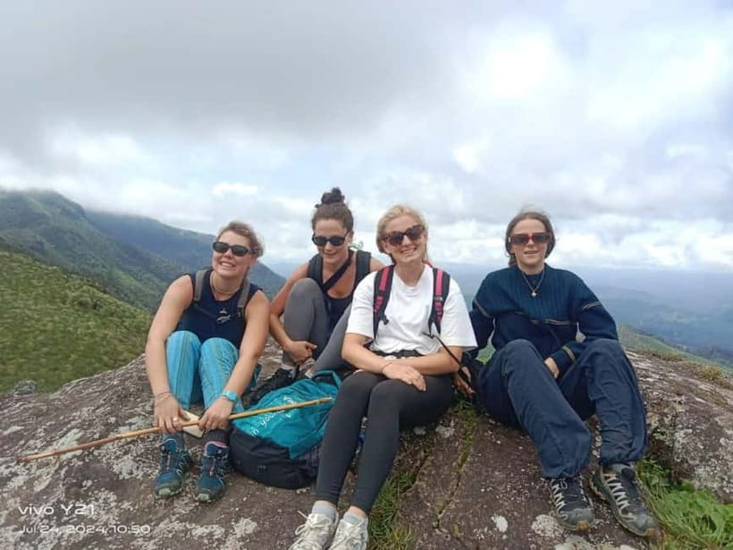
It suits active couples, solo hikers, small groups, and anyone interested in plants or birds. Small groups can make the day more personal, and one outing had only three people. Group size is not fixed in the available information, so ask if a private or small-group arrangement matters to you.
It is less suitable if you want a short, effortless outing, a guaranteed elephant sighting, or a tightly timed sightseeing tour. The route length can vary, and the experience depends partly on the guide’s pace and the day’s conditions.
Should you book the Lekshmi Hills hike?
Book it if you want a full day of real walking through Munnar’s working countryside, with meals and guiding included for a reasonable price. The strongest part is the combination of tea education, plant knowledge, mountain views, and forest time.
Before paying, confirm the expected distance, pickup details, and pace. If you are moderately fit and bring proper shoes, this should be a rewarding way to see the hills on foot. If you are unsure about your stamina, ask for the shorter route option, since the actual distance has varied from around 12 kilometers to as much as 18.
FAQ
Where does the hike begin?
The hike begins at the Munnar Info meeting point. Pickup is available from the Munnar town area.
How long does the activity last?
The scheduled duration is seven hours. The walking portion may take about six hours, with time also allowed for food and rest stops.
How far will I walk?
The stated distance is between 14 and 18 kilometers. Some outings have covered around 12 kilometers, so the exact route may vary.
How high does the hike climb?
The walk begins at about 1,420 meters above sea level and reaches a high point near 2,000 meters.
What areas does the route pass through?
The route passes through tea plantations, cardamom forests, and shola woods in the hills around Munnar and Pothamedu.
Is lunch included?
Yes. Packed food is included, along with mineral water. Snacks, tea, or coffee may also be provided during the day.
Is a guide included?
Yes. A trained English-speaking guide leads the activity. Guides named for this experience include Raja, Ramesh, and Rajain.
Do I need hiking shoes?
Comfortable shoes are required, and hiking shoes are recommended. The route includes uphill and downhill walking over natural ground.
Is transportation included?
Private transportation for pickup and drop-off is not included. Pickup is available from the Munnar town area, so confirm the exact arrangement with the provider.
Can I cancel the booking?
You can cancel up to 24 hours in advance for a full refund. The reserve-now, pay-later option is also available.
Just added around India
- Aravali Exotic Hiking, Yoga with Breakfast★ 5.0 · 13 reviews
- Guided Lama Dugh Hike in Manali★ 5.0 · 3 reviews
- 7 Day Tour to Valley of Flowers and Auli Hiking Adventure★ 5.0 · 4 reviews
- Hike to Elephant beach exploring tropical flora and fauna★ 5.0 · 4 reviews
- Hiking Day Tour to Triund from Dharamshala★ 5.0 · 75 reviews
- Guided Day Hike to Guna Devi Temple from Mcleodganj★ 5.0 · 12 reviews
- Private Peacock Trail Walking Tour in Mylapore★ 5.0 · 50 reviews
- Sunrise Day Hike in Rishikesh★ 5.0 · 8 reviews
Mountain & Summit Hikes, compared.
Sunrise Mount Batur Guided Hike with Breakfast
Read our review →
Mount Batur Sunrise Guided Hike and Natural Hot Spring
Read our review →

Mount Etna: Summit Guided Hiking Tour up to 3,400 m
Read our review →
Bovilla Lake & Gamti Mountain Hiking Day Trip
Read our review →

Mount Batur Sunrise Hike and Natural Hot Spring Option
Read our review →Browse the lists this tour appears in