
REVIEW · MOUNTAIN & SUMMIT HIKES
Mountain hiking in Munnar (Half day )
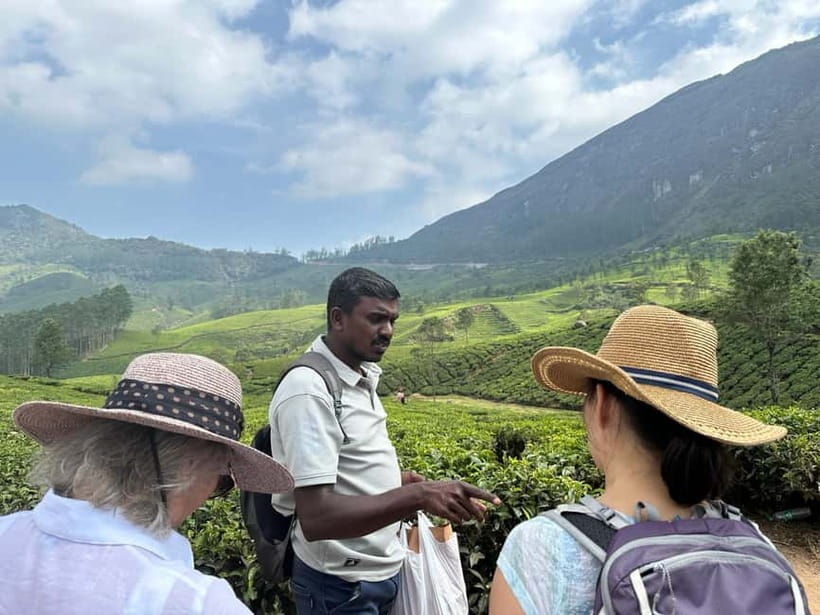
Munnar’s Lakshmi Hills offer more than a walk through tea gardens. You climb from 1,420 meters to about 1,800 meters, passing tea fields, grass-covered slopes, shola forest, spice plants, and village paths. On a clear day, you may see Anamudi and the Idukki Dam. I especially like the small group of seven or fewer and the chance to walk with guides such as Mani and Raja J., who add local detail about tea, plants, and village life.
I also like that water, light food, fruit, and tea are included. The hike has enough scenery and height to feel like a real outing, yet it remains accessible for casual hikers according to the supplied tour information. The main point to consider is the timing: the activity is sold as three hours, but the fuller description gives three and a half to four hours and an 8 to 12 kilometer route, so confirm the exact plan before booking.
Key points at a glance
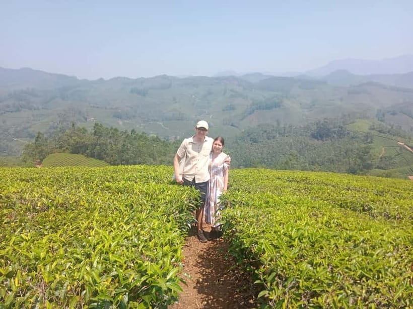
- Reach 1,800 meters: Start at 1,420 meters and climb through tea country to a high viewpoint.
- Walk through working countryside: See tea plantations, grassland, shola forest, coffee, cardamom, and cinchona.
- Look for major Kerala views: Clear skies may reveal Anamudi and the Idukki Dam.
- Travel with a personal guide: Groups are limited to seven participants, with English guiding.
- Expect practical refreshments: Water, snacks or light food, fruit, and tea are provided.
- Meet in central Munnar: The starting point is about 300 meters from the KSRTC bus station, with parking available.
A real hill walk, not just a tea plantation stroll
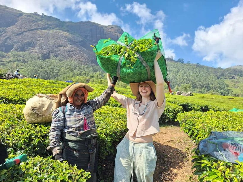
This half-day outing gives you a useful taste of Munnar’s high country. You are not simply walking beside a road and stopping for photographs. The route climbs through several types of terrain, including tea plantations, open grassland, patches of shola forest, and cultivated ground once used for coffee, cardamom, and cinchona.
That change in scenery is the best reason to choose this activity. Tea gardens are Munnar’s familiar face, but the walk helps you see how the area fits together. The neat rows of tea give way to rougher mountain slopes and small forest patches. You can also see spice plants along the way, which adds a practical link to Kerala’s farming traditions.
The route begins around 1,420 meters above sea level and reaches roughly 1,800 meters. That is enough climbing to make the hike feel rewarding without turning it into a serious mountain expedition. You should still expect uneven ground, uphill sections, and a fair amount of walking. The listed distance is 8 to 12 kilometers, so comfortable footwear matters.
More Mountain Hikes in India:
- Mountain Hiking in Munnar (half day) By Munnar Info
★ 5.0 · 390 reviews - Munnar mountain hiking (Full day)
★ 4.7 · 40 reviews - Private One Day Hiking Trip in Manali, Scenic Mountain Trail in Manali
★ 5.0 · 13 reviews
Meeting at Munnar Info and setting out
You meet at the Munnar Info meeting point, which is around 200 meters from Min Road and about 300 meters from the KSRTC Munnar bus station. The point has parking, though hotel pickup and drop-off are not included. If you are staying in central Munnar, the location should be fairly convenient on foot or by a short local ride.
The group size is limited to seven people. That matters on a hill walk. A small group lets the guide keep a better eye on the pace and terrain, and it makes it easier to ask about plants, tea production, or local places to eat and shop. Raja J. is described as attentive on the trail, helping with footing and keeping the pace comfortable. Mani is praised for adding tea and snacks during the walk.
The guide speaks English. This is useful for a tour that depends on explanation rather than just directions. You can expect the guide to point out plants, discuss tea growing, and give some local background as you move through the area.
Tea fields, spice plants, and old farm country
The early part of the walk takes you through tea plantation country. Munnar’s tea fields are visually tidy, but the more useful part of this section is learning how the land is used. The area once supported coffee, cardamom, and cinchona. Tea now covers much of the ground, but you may still see some of the older crops and spice plants.
Cardamom is especially worth noticing. It grows in the cooler, wetter parts of Kerala and is one of the region’s best-known spices. Coffee plants and cinchona are also part of the story of the hills. The guide can help you tell the plants apart and explain their place in local farming.
This is where the tour feels more personal than a self-guided viewpoint stop. You can ask questions as they come up instead of trying to identify everything later. The supplied details also point to discussion of Ayurvedic plants, so anyone interested in useful local flora should find this section rewarding.
The tea gardens are excellent for photographs, but do not expect every part of the walk to be a manicured path. The route moves between cultivated areas and more natural ground. Wear outdoor clothing that can handle dust, damp grass, and changing weather.
Climbing through grassland and shola forest
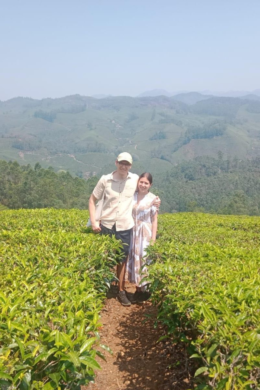
As you gain height, the scenery opens up. Grass-covered mountain slopes give you longer views, while patches of shola forest add shade and a different feel underfoot. These small forest areas are an important part of the Western Ghats setting and provide the best chance to notice local plant life and wildlife.
Wildlife sightings are not guaranteed, and this is not presented as a dedicated animal-watching tour. Still, the combination of forest, grassland, and plantation makes the walk more interesting than a route through tea fields alone. Move at the guide’s pace and keep your attention on the edges of the path. You may notice details that are easy to miss when rushing toward the viewpoint.
The route is described as accessible and easy in terms of hiking level, but the distance and climb deserve a realistic reading. Eight kilometers is a substantial walk for someone who rarely hikes, and twelve kilometers is more demanding. People with heart problems or diabetes are listed as unsuitable for the activity. The tour is also not intended for children under two, babies under one, or people over 95.
A few more hikes around India worth a look
- Full day in hiking in Munnar (By Munnar Info)
★ 5.0 · 176 reviews - Hiking Day Tour to Triund from Dharamshala
★ 5.0 · 75 reviews - Private Peacock Trail Walking Tour in Mylapore
★ 5.0 · 50 reviews - Benog Tibba Day Hike – Mussoorie
★ 5.0 · 38 reviews
The high point at 1,800 meters
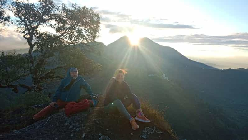
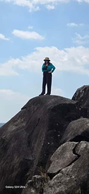
The highest point of the route is about 1,800 meters above sea level. This is the payoff for the uphill work. From open sections, you may get broad views over Munnar’s hills, tea country, and distant valleys.
On a clear day, the view may extend to Anamudi, the highest peak in southern India. You may also see the Idukki Dam, described as the highest arch dam in Asia and the third tallest dam in India. Clouds and mist can block both sights, so do not book this as a guaranteed Anamudi or dam-view excursion.
Mist is part of the appeal here. It can soften the hills and make the walk feel quiet and atmospheric, but it can also reduce visibility. The guide’s local knowledge matters most when weather changes or the path becomes less obvious. The tour information specifically recommends outdoor clothing and sunscreen. Both are sensible: mountain weather can shift, and open slopes offer little shade.
Raja J. is described as taking care with footing and making sure the group has enough energy. Fruit and snacks may be offered during the walk, while tea gives you a warm break at the viewpoint or along the route. These are small touches, but they matter on a climb.
What the half-day schedule really means
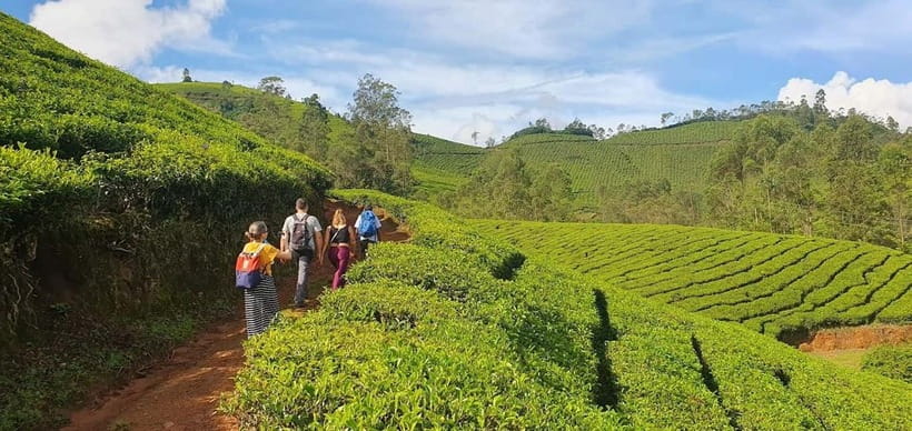
The listed activity length is three hours, while the route description says the walk may last three and a half to four hours. It also gives a finish around 12:30 to 1 p.m. This is the one practical inconsistency you should clear up before paying, especially if you have a train, lunch booking, airport transfer, or afternoon activity.
The day begins at Munnar Info, followed by a guided hike in and around Lakshmi Hills. The supplied schedule gives both a three-and-a-half-hour hiking entry and a four-hour guided walk entry. In practice, your time will depend on the chosen route, group pace, stops, weather, and how long you spend at viewpoints.
The tour is described as a morning experience finishing in Old Munnar. That timing works well if you want the afternoon free for a relaxed meal, tea shopping, or another local sight. It may also suit you if you want to avoid making a full day of hiking.
Pothamedu is mentioned as another Munnar trekking area, known for harder walks and misty valley views. The main half-day offering here focuses on Lakshmi Hills. If you specifically want Pothamedu, ask the operator before booking rather than assuming both areas are included.
What the $13 price includes
At $13 per person, this is a low-cost way to add a guided outdoor activity to a Munnar stay. The value comes from more than access to a trail. You receive an English-speaking guide, entry fees, water, and light food. The food may include fruit, snacks, and tea, based on the details provided about the walk.
A guide is particularly useful here because the route combines scenery with local information. A viewpoint alone is easy to reach by car or on a short walk, but the tea-growing background, spice plants, Ayurvedic flora, and farming history give this activity more substance.
You do need to budget separately for hotel pickup and drop-off. The central meeting point reduces that issue if you are staying near Munnar town. Parking is available at the meeting area, which helps if you have your own vehicle.
The small group also improves the value. A maximum of seven participants gives the outing a more personal feel than a large bus tour, while keeping the price modest. The tradeoff is that the exact route and pace may depend on the other people in your group.
What to bring, and what to leave behind
Bring a passport or other identification, sunscreen, and outdoor clothing. Good walking shoes are a practical addition for an 8 to 12 kilometer route, even though they are not specifically listed in the supplied requirements.
Rain protection is worth considering because Raja is described as carrying rain ponchos for the group. That tells you the weather can change, but it does not mean every departure will be wet. Tea, water, and snacks are included, so you do not need to plan the walk as a food-free outing.
Alcohol and drugs are not allowed. Alcoholic drinks cannot be carried in the vehicle, and making fires is prohibited. Electric wheelchairs and explosive substances are also listed as not permitted.
The most important preparation is an honest look at your health and walking ability. This is not a paved urban stroll. Even if the guide keeps the pace manageable, you still climb nearly 380 meters from the starting point to the high point.
How this walk compares with a do-it-yourself hike
You can see tea plantations around Munnar without booking a guide, but a self-guided walk will not automatically give you the same plant identification or local context. You may pass coffee, cardamom, or forest vegetation without knowing what you are looking at.
The guided format is also useful for route confidence. Hills can look simple from a road, yet paths through plantations and forest are not always obvious. A local guide can manage the route and help the group over uneven sections.
The downside is less freedom. You are following a planned route and group pace rather than stopping wherever you like. If you want a very short walk, a private schedule, or a late start, this half-day group outing may not suit you.
Who should book the Lakshmi Hills hike?
I would recommend this for an active visitor who wants mountain views but does not want a full-day expedition. It suits people interested in tea, spices, plants, and village life as much as people who simply want a good walk.
It is also a strong choice if you prefer a small group and direct access to a local guide. Mani and Raja J. are the named guides associated with especially thoughtful guiding, snacks, tea, fruit, and plant explanations. You cannot necessarily choose your guide, so ask when booking if that matters to you.
You should think twice if you have a heart condition, diabetes, or limited tolerance for uphill walking. The tour itself describes the route as accessible, but the distance can still be tiring. Young children and infants are excluded by the stated suitability rules.
Should you book this Munnar hike?
Book it if you want a reasonably priced half-day in the hills, enjoy walking, and value local explanation over a quick photo stop. The combination of tea gardens, spice plants, shola forest, open slopes, and possible views of Anamudi gives the route real variety.
Before booking, confirm whether your departure is closer to three hours or four, and ask about the exact distance for your date. If that timing works, this is a practical introduction to Munnar’s high country, with a small group, useful refreshments, and a guide who can help you see more than tea rows.
FAQ
How long does the Munnar mountain hike last?
The activity is listed as three hours, while the route details describe three and a half to four hours. The walk may finish around 12:30 to 1 p.m., so confirm the exact timing before booking.
How far do you walk?
The route is described as 8 to 12 kilometers. The exact distance may depend on the selected route, pace, and stops.
Where does the hike start?
You meet at the Munnar Info meeting point. It is about 200 meters from Min Road and around 300 meters from the KSRTC Munnar bus station. Parking is available.
Does the tour include hotel pickup?
No. Hotel pickup and drop-off are not included, and any related charge is separate.
What is included in the price?
The price includes a guide, entry fee, water, and light food. The walk may also include fruit, snacks, and tea.
What language does the guide speak?
The tour is guided in English.
How large is the group?
It is a small-group activity limited to seven participants.
What should I bring?
Bring a passport or identification, sunscreen, and outdoor clothing. Comfortable walking shoes and rain protection are practical choices for the hill route.
Is the hike suitable for everyone?
No. It is not suitable for children under two, babies under one, people with heart problems, people with diabetes, or people over 95. Alcohol, drugs, fires, explosive substances, and alcoholic drinks in the vehicle are not allowed.
Just added around India
- Aravali Exotic Hiking, Yoga with Breakfast★ 5.0 · 13 reviews
- Guided Lama Dugh Hike in Manali★ 5.0 · 3 reviews
- 7 Day Tour to Valley of Flowers and Auli Hiking Adventure★ 5.0 · 4 reviews
- Hike to Elephant beach exploring tropical flora and fauna★ 5.0 · 4 reviews
- Hiking Day Tour to Triund from Dharamshala★ 5.0 · 75 reviews
- Guided Day Hike to Guna Devi Temple from Mcleodganj★ 5.0 · 12 reviews
- Private Peacock Trail Walking Tour in Mylapore★ 5.0 · 50 reviews
- Sunrise Day Hike in Rishikesh★ 5.0 · 8 reviews
Mountain & Summit Hikes, compared.
Sunrise Mount Batur Guided Hike with Breakfast
Read our review →
Mount Batur Sunrise Guided Hike and Natural Hot Spring
Read our review →

Mount Etna: Summit Guided Hiking Tour up to 3,400 m
Read our review →
Bovilla Lake & Gamti Mountain Hiking Day Trip
Read our review →

Mount Batur Sunrise Hike and Natural Hot Spring Option
Read our review →Browse the lists this tour appears in