
REVIEW · MEXICO
Hiking Excursion to the Iztaccíhuatl Volcano from Puebla
The real appeal here is choice. At Paso de Cortés, you do not get pushed into one fixed climb. Your certified guide explains three routes, then matches the walk to your fitness, the weather, and how your body is handling the altitude. You may take an easier viewpoint trail, a longer route through forest and springs, or the steep Ruta de Portillos.
I like the private round-trip transport from Puebla or Cholula, especially because the road into the park can be rough enough that taxis and rideshare cars may not take you there. I also like the calm, personal guiding style reported with Luis and Rafa, who adjust the pace, plan rest stops, and share local details along the way.
The main catch is altitude. The routes reach between 3,670 and 4,300 meters above sea level, so an ordinary hike at home may feel much harder here. The early start, changing weather, no included food, and strict cancellation policy also deserve attention before you pay the $193.86 price.
Key points to know before you book
- Three difficulty levels: Choose a marked viewpoint walk, a longer forest and spring route, or the steep Ruta de Portillos.
- High-altitude hiking: Routes reach as high as 4,300 meters, where pace and breathing matter more than speed.
- Strong guide service: Luis and Rafa are repeatedly praised for good pacing, local insight, safety awareness, and friendly conversation.
- Useful private transport: Pickup covers hotels, Airbnbs, homes, or other addresses in Puebla and Cholula.
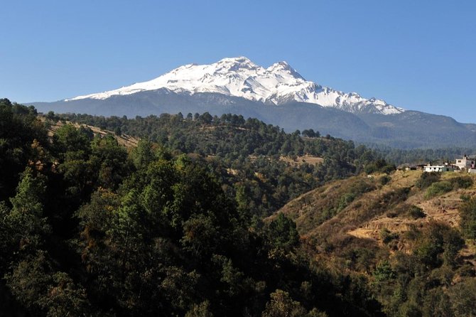
- Volcano views depend on weather: You may see both Iztaccíhuatl and Popocatépetl clearly, but clouds can arrive quickly.
- Bring your own food and water: Breakfast and lunch are not included, and the hike can last about five hours.
Leaving Puebla at 6 a.m. for the volcanoes
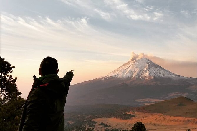
Pickup begins at 6 a.m. from an address in Puebla or Cholula. That early hour is practical rather than painful. Morning usually offers cooler hiking conditions and less crowded trails, and it gives you the best chance of seeing the volcanoes before clouds build later in the day.
The full outing takes about eight to nine hours, including the drive, preparation, hiking, rest stops, and return trip. You should plan most of the day around it. This is not a quick mountain photo stop squeezed between two city attractions.
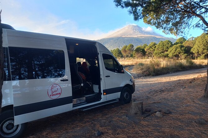
The vehicle is private, which matters here. One particularly useful detail is the rough road leading toward the national park. A regular taxi or rideshare may refuse the trip, and a standard rental car could be damaged. Having transport arranged removes a real headache and adds value to the price.
The group can include up to 15 people. That is small enough for a guide to manage the pace, though your experience will still depend on the fitness and altitude tolerance of the people on your departure. The guide speaks English, and pickup instructions are handled when you book.
More Volcano Hikes in Mexico
- Iztaccihuatl Volcano Hike with an Alpinist
★ 4.0 · 244 reviews - From Mexico City: Hike Iztaccihuatl Volcano with an Alpinist
★ 4.3 · 155 reviews - Hike at Nevado de Toluca Volcano
★ 5.0 · 69 reviews
Paso de Cortés: choosing the right route
At Paso de Cortés, you leave the vehicle and prepare for the walk. This is the key decision point. Your guide gives safety instructions, explains the routes, and helps you choose one of three options.
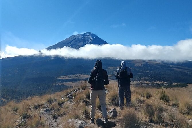
Paso de Cortés is also a worthwhile part of the day because it places you between the two famous volcanoes, Iztaccíhuatl and Popocatépetl. The views can be wide and dramatic, though clear sightlines are never guaranteed. Weather in the mountains can shift from sunshine to cloud and light rain during the same hike.
Do not treat the route choice as a simple easy, medium, or hard label. At this altitude, a route that sounds manageable on paper can test you quickly. Your guide may also judge the conditions and adjust the plan. That flexibility is one of the best reasons to book a guided outing rather than follow a fixed independent schedule.
Level 1: the most forgiving way to see Iztaccíhuatl
Level 1 follows marked trails toward Iztaccíhuatl and reaches a viewpoint where you can admire both Iztaccíhuatl and Popocatépetl. The stated distance is 9 to 11 kilometers, with elevations from 3,670 to 4,000 meters and a listed 330-meter drop.
This is the right choice if your priority is scenery rather than pushing for a demanding climb. It is also a sensible starting point if you come from sea level or have not spent much time at altitude. The walk is described as harmonious and scenic, and the route lets you take in the volcanic setting without committing to the steepest terrain.
Level 1 is not a casual stroll in the city. Ten kilometers at high altitude can still leave you tired, particularly if you are unused to thin air. A past outing also showed that the guide may suggest extending the route if you are handling the height well. That can be a useful option, but you should not feel pressured to upgrade.
The route also offers chances to notice plants and wildlife. One guide pointed out flora and fauna along the way, and hummingbirds have been seen in summer. Those small details help make the outing more than a march toward a viewpoint.
Level 2: the best balance of scenery and effort
Level 2 is the most appealing middle choice for many active visitors. It covers about 14.5 to 15 kilometers and reaches between 3,670 and 4,100 meters, with a listed 580-meter drop. The trail passes through forest and an area of springs, with sections across grassland and uphill ground where the path is less clearly marked.
This route gives you more time in the park and more varied surroundings than Level 1. The springs and waterfall are particular highlights. You also get broad views of both volcanoes when the weather cooperates.
The tradeoff is effort. A fit hiker may find the route manageable, but the altitude makes it more demanding than the distance suggests. One couple in their sixties completed Level 2 with regular breaks and found the final four kilometers the hardest. That is a useful warning: you do not need to be an elite climber, but you should have a moderate level of fitness and be ready for a long day.
Level 2 may be the sweet spot if you hike regularly and want a real mountain outing without choosing the steepest option. The route is not described as technical, and some sections are well maintained, but portions are off-road and uphill. Good shoes are important.
Same trailhead, a different sort of day:
- Matacanes : Canyoning + Hiking + Water Jumps + Rappel + Caves
★ 5.0 · 1,497 reviews - Nido de los Aguiluchos, Monterrey: Hiking + Rock Climbing + 3 Rappels
★ 5.0 · 713 reviews - Puerto Vallarta: Full Day Hike to 6 Hidden Beaches & Snorkel
★ 4.8 · 403 reviews - Los Cabos: Hiking at the Fox Canyon with Waterfall
★ 5.0 · 369 reviews
Level 3: the steep Ruta de Portillos
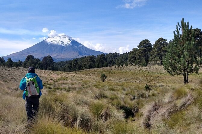
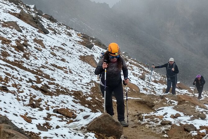
Level 3 is the shortest route by distance, at about 7 kilometers, but it is the toughest because of the altitude and slope. It runs between 3,900 and 4,300 meters and includes a listed 420-meter drop. The stone, sand, and sloping paths lead toward the second or third gate of the Ruta de Portillos, depending on the weather.
Do not mistake fewer kilometers for an easy day. This is the high route, with panoramic views when the sky is open and a steep ascent that can take roughly two hours upward and one hour down, not counting breaks. The total Level 3 outing is generally around five hours, though group pace and altitude adjustment can change that.
This option suits experienced hikers who are comfortable with steep ground and high elevations. It is also the route most affected by weather and personal condition. Helmets and walking poles have been provided, and the guide adjusts speed to the group. Those safety measures are reassuring, but they do not remove the physical demands.
If you want a longer day on the trail, choose Level 2 instead. If you want higher ground and panoramic views, and you are ready for a steep climb, Level 3 is the more fitting choice.
What the guides add to the day
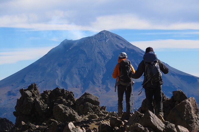
The strongest part of this experience is the guiding. Luis is repeatedly praised for his pacing, mountain experience, local stories, and easy conversation about Puebla, Mexico, hiking, and travel. Rafa is also noted for knowing when to stop and rest, especially on Level 2.
That matters because altitude hiking is not just about reaching a point on a map. A good guide watches breathing, pace, weather, and group energy. The better approach is to take steady breaks before you are exhausted, rather than race uphill and struggle later.
The guides also make the outing feel personal. You may learn about the area, local plants, wildlife, and the changing mountain conditions. This is not a lecture-heavy tour, but the walk can include plenty of conversation if you want it.
Safety equipment is included. Reports describe helmets and walking poles being available, and the tour includes a certified professional guide. Still, you remain responsible for arriving prepared and telling the guide if you feel unwell.
Views, clouds, and mountain weather
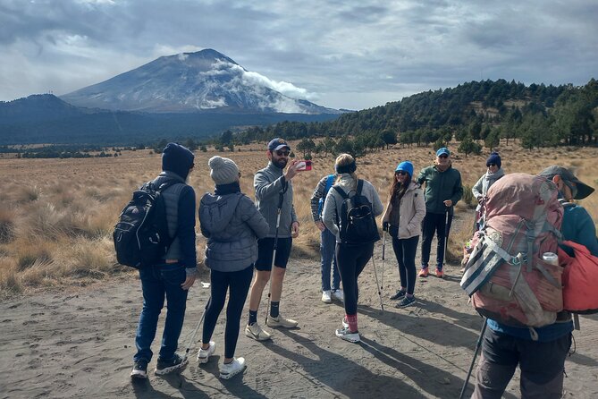
The volcano views can be exceptional, but they are not guaranteed. Several outings had clear views of Popocatépetl and Iztaccíhuatl, while another had cloudy conditions that hid much of the mountain. Even on a good morning, clouds may roll in after lunch.
You may experience sun, cloud, and light rain within five hours. Bring layers and something that protects you from cold and wet conditions. A useful clothing combination from one outing included a T-shirt, midlayer, and fleece, though the exact choice depends on the day.
The best attitude is to value the walk itself, not just a perfect volcano photograph. Clear weather can make the day spectacular. Cloudy weather can still provide a rewarding high-mountain hike, but you should not book this solely for guaranteed views.
What to pack for a comfortable hike
Breakfast and lunch are not included, so bring food for the morning and a picnic lunch. You also need enough water for the full route. One practical suggestion was four liters for two people, which gives you a useful starting point for planning.
Pack:
- Plenty of water
- Breakfast and a packed lunch
- Sturdy hiking shoes
- Warm layers
- Rain protection
- Sun protection
- Small personal essentials for a full day outdoors
The tour supplies safety equipment, but that does not replace proper clothing or footwear. Level 2 and Level 3 include uneven, sandy, stony, and uphill sections. Comfortable city sneakers are a poor choice.
Is $193.86 a fair price?
At $193.86 per person, this is not a budget walk. The value comes from the combination of private round-trip transport, park entry, safety equipment, a certified guide, and the ability to choose among three routes.
The transport alone solves a difficult access problem. If taxis and rideshare cars will not take you up to the park, arranging a vehicle is more than a convenience. It may be the difference between making the hike and spending the morning trying to find a way there.
You also get a full day in a protected mountain area, with an English-speaking guide who can adjust the plan. For a first visit to Iztaccíhuatl from Puebla, that support is worth considering, especially if you are not comfortable navigating rough roads and high-altitude trails alone.
The price is harder to justify if you already have suitable transport, mountain experience, and a way to enter the park independently. It is also poor value if you want a guaranteed summit or a technical mountaineering climb. This is a guided high-altitude hike with three route choices, not a summit expedition.
Who should book this hike?
I would recommend it to active visitors staying in Puebla or Cholula who want a serious day outdoors and prefer local guidance. Level 1 works for people seeking a scenic route with less strain, while Level 2 is a strong fit for regular hikers who want forest, springs, waterfalls, and more distance.
Level 3 is best for experienced hikers who understand that altitude can change the difficulty of familiar terrain. You should have moderate physical fitness at minimum, and you need to be honest with yourself about steep climbs and elevations above 4,000 meters.
I would not choose it if you need an easy, predictable sightseeing day, dislike early starts, or are unprepared for changing weather. The route can be adapted, but the mountain cannot be made low, warm, or cloud-free.
The experience is non-refundable and cannot be changed for personal reasons. If poor weather forces cancellation, you are offered another date or a full refund. That makes checking the forecast before booking especially important.
Should you book the Iztaccíhuatl excursion?
Book it if you want a genuine mountain day from Puebla, need dependable transport, and like having a guide who can match the route to your ability. The best value is likely Level 1 or Level 2, with Level 2 offering the strongest mix of scenery and challenge for fit hikers.
Choose Level 3 only if you are ready for steep, high-altitude terrain. Pack food, water, layers, and proper shoes, then let Luis, Rafa, or another certified guide set the pace. If you accept that weather may hide the volcanoes and that the altitude will demand patience, this can be one of the most memorable outdoor trips in the Puebla area.
FAQ
Where does the Iztaccíhuatl hike begin?
The tour begins with pickup in Puebla City or Cholula, followed by transport to Paso de Cortés. You leave the vehicle there and begin the hike after receiving instructions from the guide.
What time is pickup?
The stated start time is 6 a.m. Pickup is available from a hotel, Airbnb, home, or another reference point within Puebla or Cholula.
How long does the full excursion last?
The full experience takes approximately eight to nine hours. The hiking portion at Iztaccíhuatl and Popocatépetl National Park is listed as about five hours.
How many route options are available?
You can choose among three route levels. Level 1 is a marked scenic walk, Level 2 is longer and includes forest, springs, and uphill sections, and Level 3 follows the high Ruta de Portillos over steep stone and sandy paths.
How high do the routes go?
The routes range from about 3,670 meters to 4,300 meters above sea level. Level 3 reaches the highest elevation.
Is food included?
No. Breakfast and lunch are not included, so you should bring food for the morning and a packed lunch. Water is also your responsibility.
Is transportation included?
Yes. Round-trip private transportation and pickup are included for addresses in Puebla or Cholula.
What happens if bad weather cancels the tour?
The experience requires good weather. If it is canceled because of poor weather, you are offered a different date or a full refund. Personal cancellations or requested changes are non-refundable.
Just added around Mexico
- From Puebla: Malinche mountain Hiking private Tour★ 4.9 · 3 reviews
- From Puebla: Hiking in the Iztaccíhuatl all included★ 4.3 · 12 reviews
- From Oaxaca: Sierra Norte Hike & Indigenous Village Full-Day★ 4.9 · 16 reviews
- From Mexico City: Full Day Volcano Crater and Lake Hike★ 4.8 · 10 reviews
- From Loreto: Canipole Cave Painting Guided Hike★ 4.9 · 4 reviews
- From Loreto: Tabor Canyon Guided Hike★ 3.8 · 6 reviews
- Cancún: Guided Birdwatching Hike★ 5.0 · 6 reviews
- Fox Canyon: Day Hike★ 4.9 · 9 reviews
Mexico Hiking Tours, compared.
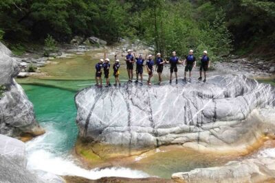
Matacanes : Canyoning + Hiking + Water Jumps + Rappel + Caves
Read our review →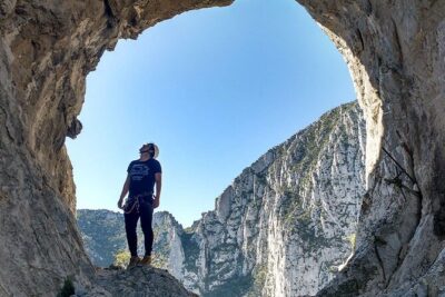
Nido de los Aguiluchos, Monterrey: Hiking + Rock Climbing + 3 Rappels
Read our review →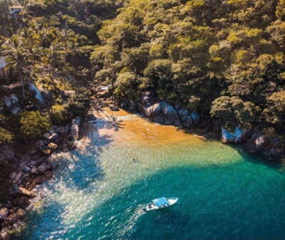
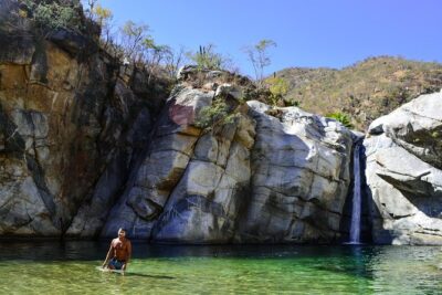
Los Cabos: Hiking at the Fox Canyon with Waterfall
Read our review →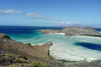
Balandra & Tecolote: hike, kayak and snorkel in paradise
Read our review →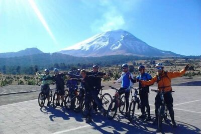
Browse the lists this tour appears in