
REVIEW · SPAIN
Hiking experience in the High Sierra Nevada National Park
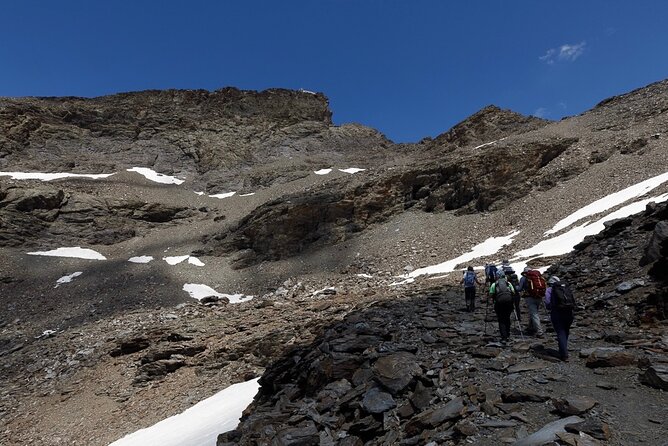
The striking thing here is the quick change from hot Granada streets to high mountain air. In about 45 minutes, you reach the Sierra Nevada road at roughly 8,200 feet, then walk through the glacial San Juan Valley toward Tajos del Campanario, above 10,000 feet. The reward is a quiet day among snowfields, waterfalls, wildflowers, and sharp mountain views.
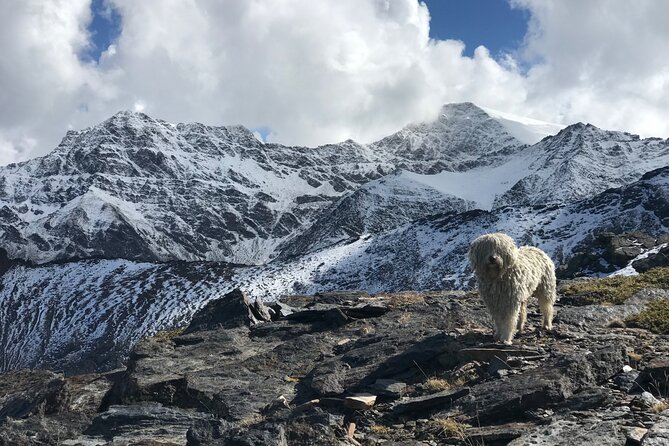
I like the small groups of up to eight, which let the guide adjust the pace instead of dragging everyone along at one speed. I also like the human touch of guides such as Jaime, often accompanied by his friendly dog Kai, plus the chance to spot mountain goats, vultures, eagles, and unusual high-altitude plants.
The catch is simple: this is not a gentle stroll. You begin high and climb higher, with thin air, steep sections, and loose rock underfoot. Trainers can work, but good trail shoes with grip and ankle support are a much safer choice.
Key points to know before booking
- Start high at 2,500 meters: You skip the long climb from the valley floor, but the altitude affects your breathing from the first step.
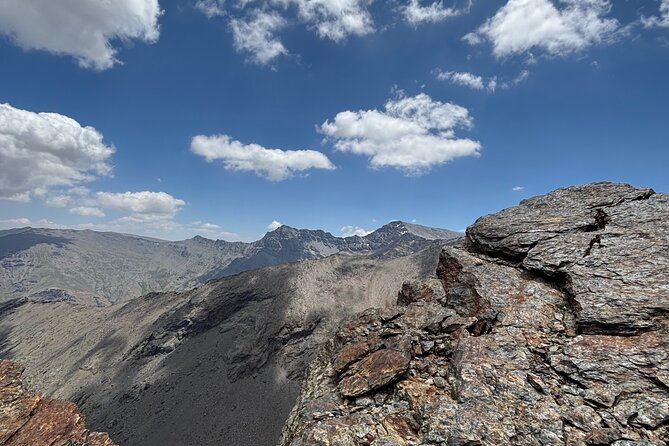
- Reach more than 3,000 meters: Tajos del Campanario brings views toward Mulhacén, Veleta, and Alcazaba.
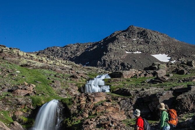
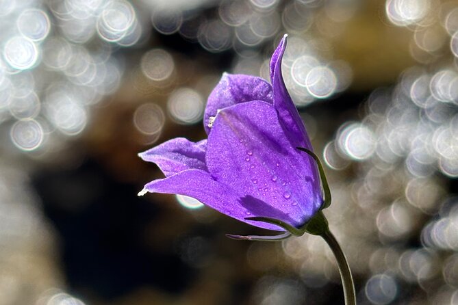
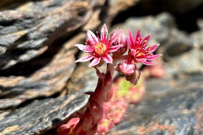
- Walk through San Juan Valley: Expect glacial features, water, wildflowers, lakes, waterfalls, and polished rock.
- Small-group guiding: Groups are capped at eight, with rest stops and a pace set for the people present.
- Bring your own picnic: Food and drinks are not included, and you should carry plenty of water.
- Weather changes fast: Warm clothes, gloves, a hat, and a waterproof layer can matter even when Granada is hot.
From Granada heat to the high Sierra Nevada
This outing gives you a sharp contrast to Granada’s streets, patios, and monuments. You meet at Plaza de Mariana Pineda at 9:00 a.m., then ride by private vehicle toward the Sierra Nevada road. The drive takes about 45 minutes according to the experience details given by past participants, though the full day lasts roughly seven hours including transport.
The road climbs to about 2,500 meters. That starting point matters. You are not spending half the day grinding uphill from a low valley. Instead, you begin in high mountain country and use your energy for a route through the upper Sierra Nevada.
The temperature can be surprisingly different from Granada. One day may feel like summer in the city and cool spring in the mountains. At altitude, wind can make the air feel colder still. Pack for the mountain, not the forecast in town.
The Sierra Nevada rises between Granada and Almería. Its highest summit, Mulhacén, reaches 3,482 meters, the highest point on the Iberian Peninsula. The route does not take you to Mulhacén, but it gives you striking views toward that peak and the surrounding summits.
More National Park Hikes in Spain:
- La Palma: Caldera de Taburiente National Park Guided Hike
★ 4.8 · 140 reviews - San Francisco: Yosemite National Park & Giant Sequoias Hike
★ 4.5 · 1,777 reviews - Skaftafell National Park: Falljokull Glacier Advanced Hike
★ 4.8 · 1,083 reviews
San Juan Valley and the work of ancient ice
The walk begins through the San Juan Valley, described as one of the most beautiful glacial valleys in the range. Ice shaped this terrain over thousands of years, leaving behind rounded rock, hollows, watercourses, and high lakes.
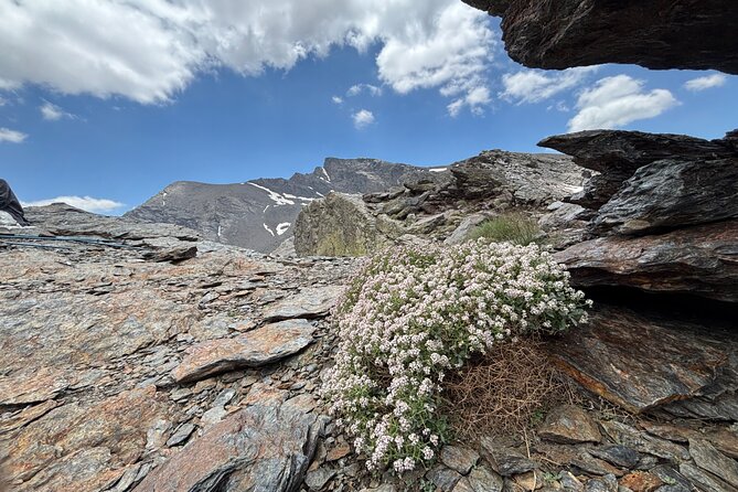
This is where the guide adds real value. A good mountain leader can point out why the rock looks polished, where water is flowing from melting snow, and how the valley took its present form. Guides also identify plants and insects found in this harsh setting. The scenery is not just pretty. It gives you a lesson in how a mountain is built and worn down.
Expect flowing water, waterfalls, shiny rocks, and wildflowers along the route. Depending on the season, snow may remain on the upper slopes, even when Granada is very warm. One June outing included snowy peaks, horses, cows, goats, and regional flowers. Conditions change, so you should not book this expecting one fixed version of the route.
Wildlife is another draw. Mountain goats are a realistic possibility, and the area can also produce sightings of eagles, vultures, and birds that migrate from Africa. Nobody can promise an animal encounter, but the open slopes and quiet route give you a fair chance to notice wildlife.
Posiciones del Veleta and the Spanish Civil War
Partway along, you reach Posiciones del Veleta. Fortifications built during the Spanish Civil War remain here, looking across the northern face of the Sierra Nevada.
This stop adds a human layer to a day otherwise shaped by ice, stone, plants, and weather. The old positions also make a good pause point, with broad views across the upper range and toward snowfields that can remain through the year.
Your guide sets the pace and makes several stops. That is important at altitude. You may feel fine on the first section, then notice that every uphill step takes more effort. The route is not described as technically difficult, but parts can be steep, and loose slate can become slippery in rain or wind.
You do not need to be a mountaineer. You do need a moderate level of fitness and some comfort with sustained uphill walking. Regular running, cycling, swimming, or tennis is a useful base. If you are not used to hills, the route may feel harder than its distance suggests because of the height.
The climb to Tajos del Campanario
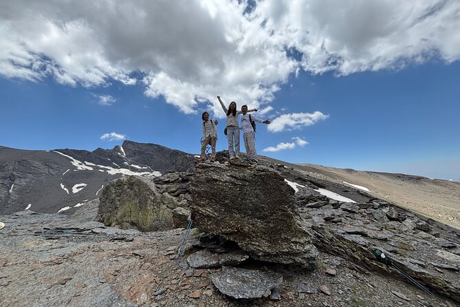
The main physical challenge comes as you gain more than 3,000 meters and approach the top of Tajos del Campanario. The final uphill sections can demand real effort, particularly after two or three hours on the trail.
The reward is a wide view toward the northern faces of Mulhacén, Veleta, and Alcazaba. You also get the stark beauty of the high Sierra Nevada: spare rock, snowfields, open sky, and very little city noise.
This is the point where the small group setup helps. Jaime, one of the guides frequently associated with this outing, is praised for keeping different fitness levels together and offering encouragement without turning the day into a race. Other guides, including Buitre and Jesus, have also led the walk. The pace can be adjusted, and there are places where you can wait if you become too tired to continue with the group.
That option is useful, but do not treat it as an easy escape from the climb. You are still committing to a long day at altitude. If your goal is a relaxed scenic ride with only a few steps, choose something else around Granada.
A few more hikes around Spain worth a look
- From Valencia: Montanejos Guided Hike with Natural Pools
★ 4.5 · 1,741 reviews - From Seville: Caminito del Rey Hike Day Trip
★ 4.5 · 1,240 reviews - Lanzarote: Hike Across Timanfaya’s Volcanic Landscapes
★ 4.8 · 1,234 reviews - The Volcano Heart Tour: Hiking, Tasting and Sunset Experience
★ 5.0 · 1,120 reviews
What the guide adds to the day
The guide is more than someone who points toward the next bend. A UIMLA mountain guide leads the experience, with attention to route choice, weather, group pace, and mountain safety. Guides explain local plants, animals, rocks, and the area’s past when conditions allow.
Jaime receives particularly warm praise for his calm manner and strong command of the terrain. He often guides with Kai, his dog, who has become part of the experience for many groups. Kai is especially popular when snow is present, but the practical benefit is Jaime’s ability to keep the walk organized while giving people room to move at a comfortable pace.
The guide may also adjust the route. On one outing, an experienced participant was offered a harder section. That kind of flexibility is useful, but you should not assume an advanced route will always be included. The standard plan already offers plenty of work.
English is offered, and Jaime also speaks Spanish. If you are learning Spanish, the setting gives you an easy chance to practice during breaks and on gentler sections of the path.
Footwear, poles, and mountain clothing
The operator says sneakers or trainers are acceptable. That is true in the narrow sense that the route does not require technical mountaineering boots. Still, several practical details point to a better choice.
Much of the route is rocky. Loose slate can shift underfoot, and wet weather makes it slick. I would choose trail shoes or hiking boots with a firm sole. Ankle support is helpful, especially if you are carrying a pack or are not used to uneven ground.
Hiking poles are supplied according to the experience details, and they are genuinely useful on steep or loose sections. One outing had too few poles available, so it is sensible to confirm this before departure if poles are important for your balance. If you need borrowed footwear, ask several days ahead rather than assuming a full range of sizes will be waiting.
The operator can provide warm clothing. That may include gloves, hats, or other layers, depending on what is available. Do not rely on this as your whole clothing plan. Bring:
- A light insulating layer
- A windproof or waterproof jacket
- Long activewear trousers
- A hat and sunscreen
- Trail shoes or hiking boots
- At least 1.5 to 2 liters of water
- Snacks and a packed lunch
You can have a hot city morning and still need gloves higher up. Rain and wind have arrived unexpectedly on this route, so a compact waterproof layer is a wise addition.
Food, breaks, and the seven-hour schedule
Food and drinks are not included. Pack lunch, snacks, and enough water for a full day at altitude. A sandwich, nuts, fruit, or another compact meal will fit the rhythm of the walk.
The guide makes several stops, both for rest and for views. You may stop beside water, near the old fortifications, or at a high point with the major peaks in view. Breaks also help you eat and drink before fatigue becomes a problem.
The exact walking time can vary. The advertised duration is about seven hours, and one outing involved roughly five hours of hiking plus two hours in the vehicle. The group’s pace, weather, and route choices all affect the day.
Plan to return to the Plaza de Mariana Pineda around late afternoon, often close to 4:00 p.m. If you have a train, dinner reservation, or another fixed plan, leave a generous buffer. One guide made sure a participant reached town in time for a train, but that should not be treated as a guarantee.
Is $71.35 a fair price?
At $71.35 per person, this is a strong value if you want a full day outside Granada without arranging a vehicle, route, guide, and safety cover yourself.
The price includes private transport, a UIMLA mountain guide, assistance and liability insurance, and a small group capped at eight. It does not include lunch or drinks, so add the cost of your own picnic and any clothing or footwear you need.
A large group could offer a lower headline price, but it would likely be less personal. Here, a guide can slow down for a tired hiker, explain a plant or rock, and keep the group together on rough ground. That matters more than a minor saving if you are new to high-altitude walking.
The value is best for people who want scenery and exercise in the same package. If you only want mountain views, the drive and a shorter walk may suit you better. If you want an active day with a summit goal, this price is reasonable.
Who should book this hike?
You should consider it if you exercise regularly and enjoy a challenge. A fit beginner can manage the route with breaks, but you should be honest about your stamina. The final climb is not a token walk, and the thinner air makes the effort feel greater.
The outing can work for mixed abilities. Guides have paced groups for a fit teenager and an unfit person in their 60s, and tired participants can wait at suitable points. Still, the whole group must respect the mountain and the slowest person’s pace.
This is a good choice for:
- Anyone wanting a cool escape from Granada’s summer heat
- Hikers interested in geology, wildlife, and mountain plants
- People who prefer small groups
- Visitors who want a guide rather than a self-guided route
- Fit families or mixed-age groups comfortable with uphill walking
It is a poor match if you dislike uneven ground, have no experience with sustained exercise, or want a casual outing in city clothes.
Booking is flexible with free cancellation up to 24 hours before the start time. The experience depends on suitable weather. If poor conditions force a cancellation, you can choose another date or receive a full refund.
Should you book the Sierra Nevada hike?
Book it if you want one of Granada’s best changes of pace: a cool, quiet day above the city, with glacial valleys, Civil War fortifications, high peaks, and a real uphill finish.
Pack properly, bring lunch and water, and use trail shoes rather than flimsy trainers. The strongest reason to choose this outing is the combination of small-group transport and experienced mountain guiding. The main reason to hesitate is the altitude and effort.
If that sounds like a challenge you would enjoy, $71.35 buys a memorable day in the high Sierra Nevada. If it sounds tiring before you even start, choose a gentler mountain visit.
FAQ
Where does the hike start?
You meet at Plaza de Mariana Pineda in central Granada at 9:00 a.m. Transport then takes you to the top of the Sierra Nevada road, about 2,500 meters above sea level.
Where does the experience end?
The activity ends back at the meeting point, Plaza de Mariana Pineda.
How long does the experience last?
The full experience lasts about seven hours. This includes transport between Granada and the mountain area and several hours of hiking.
How high does the hike go?
The route gains more than 3,000 meters in elevation and reaches the top of Tajos del Campanario. You begin at roughly 2,500 meters.
How large is the group?
The group has a maximum of eight people.
Is food included?
No. Food and drinks are not included unless specifically stated. Bring lunch, snacks, and plenty of water.
Do I need hiking boots?
Sneakers or trainers are allowed, but trail shoes or hiking boots with good grip are a better choice for rocky and sometimes slippery ground.
Are hiking poles and warm clothes available?
The experience includes hiking poles and warm clothing can be provided. Availability of particular clothing or footwear sizes should be confirmed in advance.
Can I cancel for a refund?
You can cancel at least 24 hours before the start time for a full refund. If poor weather causes the operator to cancel, you will be offered another date or a full refund.
Just added around Spain
- Fuerteventura sunset hike to the wild west coast★ 4.9 · 14 reviews
- Fuerteventura: COFETE HIKING TOUR: Pick up in the SOUTH★ 5.0 · 13 reviews
- Fuerteventura: Ajuy Caves & hike to secret Las Penitas Arco★ 4.9 · 43 reviews
- Fuerteventura: Hiking on the sacred mountain El Cardon★ 4.6 · 3 reviews
- From Valencia: Hiking Tour to Two Stunning Waterfalls★ 5.0 · 3 reviews
- Private Hiking Tour of The Red Canyon of Teruel★ 5.0 · 4 reviews
- From Valencia: Peña Cortada Private Hiking Day Tour★ 5.0 · 13 reviews
- From San Sebastian: Guided Coastal Hike with Winery Tasting★ 4.9 · 14 reviews
Spain Hiking Tours, compared.
The Volcano Heart Tour: Hiking, Tasting and Sunset Experience
Read our review →
Caminito del Rey: Guided Hiking Tour with Entrance Tickets
Read our review →Browse the lists this tour appears in