
REVIEW · MOUNTAIN & SUMMIT HIKES
La Paz: Charquini Mountain Guided Hike
Laguna Esmeralda is the prize here: a mineral-rich mountain lake at about 5,024 meters, reached by a short but serious high-altitude hike. The route also gives you views of Huayna Potosí, Chacaltaya, Lake Milluni, llamas, alpacas, and the stark mining country outside La Paz.
I like the easy transport from the city and the way the guide-led hike lets you move at your own pace. I also like the small-group format, snacks, walking sticks, and emergency oxygen. The catch is simple: the hike is harder than its distance suggests, because thin air, cold, steep ground, and fast weather changes all matter.
Key points to know before booking
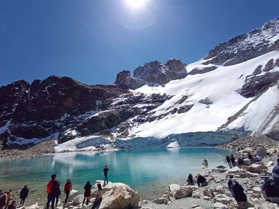
- Laguna Esmeralda sits at about 5,024 meters, so altitude is the main challenge, not trail length.
- The uphill walk usually takes 45 minutes to 2 hours, depending on pace and conditions.
- The route includes Apacheta Jilarata, Milluni Cemetery, and Laguna Milluni, not just the final lake.
- Guides stay with slower walkers, with Manuel, Paty, Juan, Marcos, and Adriano receiving especially warm praise for patience and care.
- The scenery can change quickly, from clear mountain views to snow, hail, cloud, or poor visibility.
- The $39 price is strong value for transport, a licensed guide, snacks, walking sticks, and a full day outside La Paz.
Why Laguna Esmeralda makes this a good La Paz day trip
Nevado Charquini rises to 5,390 meters, but this excursion does not take you to the summit. The goal is the lake, reached from a trailhead at roughly 4,600 meters. That distinction matters. You get a taste of Bolivia’s high Andes without signing up for a multi-day mountaineering trip.
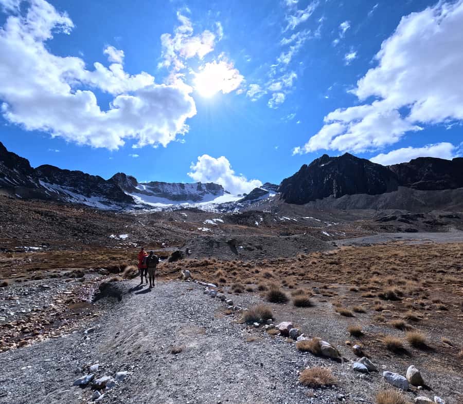
The lake is framed by Charquini’s rocky slopes and, depending on the season and weather, snow and ice. Clear days bring the best views. In colder months, part of the water can freeze. In wet weather, you may get snow or hail at the lake, and the mountains can disappear behind cloud.
I would think of this as a high-altitude scenic walk, not a long trek. The actual hiking time is commonly around two hours in total, though the advertised schedule allows about three hours for the stop. That extra time gives the group room for photos, rest, and slower walkers.
The short route can be misleading. Several people find the trail physically manageable but breathing difficult. If you are acclimatized in La Paz, the walk may feel like a useful test before a longer trek. If you have only just arrived from lower altitude, the same path can feel very demanding.
More Mountain Hikes in the world:
- Berber villages : Atlas Mountains Day Hike from Marrakech
★ 5.0 · 14,007 reviews - Bali: Sunrise Mount Batur Guided Hike with Breakfast
★ 4.8 · 9,660 reviews - Bali: Mount Batur Sunrise Guided Hike and Natural Hot Spring
★ 4.8 · 9,284 reviews
Leaving La Paz and crossing the altiplano
The meeting point is at Buhos Tours near San Francisco Church or Which Market. The day begins early, and the drive takes you out of the city toward the high altiplano. The vehicle ride is part of the experience, since there is no practical way to reach the Charquini trailhead independently without suitable transport.
The drive includes rough sections, and the road can be bumpy. Vehicles have been described as comfortable and adequate, though condition may vary. One guide, Manuel, handled a flat tire during a trip and changed it with a proper spare, which gives you some idea of the practical nature of the route.
Do not be surprised if departure runs late. Some groups have waited around 30 minutes, and one reported a later start of about an hour. The operator may also stop so you can buy forgotten items such as sunscreen, sunglasses, socks, snacks, or gloves. That can be useful, but it also means the day may not match the clock exactly.
The full outing is listed as eight hours, with a return to La Paz around 3:30 p.m. In practice, some groups finish closer to six hours or return earlier. This depends on the start time, road conditions, group pace, and time spent at the lake.
Apacheta Jilarata and the first mountain views
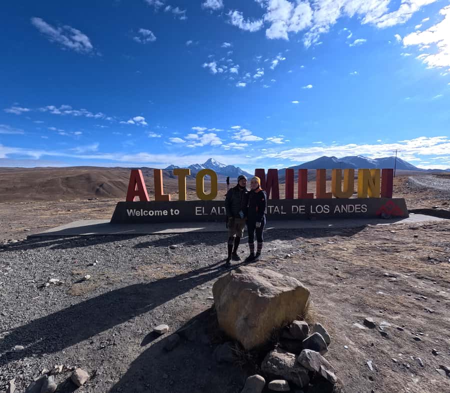
The first notable stop is Apacheta Jilarata, used as a viewpoint and photo stop. At more than 4,100 meters, it gives you an early taste of the scale and openness of the altiplano.
This is a good place to put on extra layers. Wind can be fierce, even when the sun feels strong. The air is thin, and a few minutes standing still can feel colder than walking.
From here, you may see the broad Andean ranges and, when the weather cooperates, Huayna Potosí and Chacaltaya. These views are weather dependent. On cloudy or snowy days, the stop is still atmospheric, but the distant peaks may vanish completely.
That uncertainty is part of the deal. This is not a museum visit with a guaranteed view. You are going high into exposed country, and the sky can change during the drive.
Milluni Cemetery and Laguna Milluni
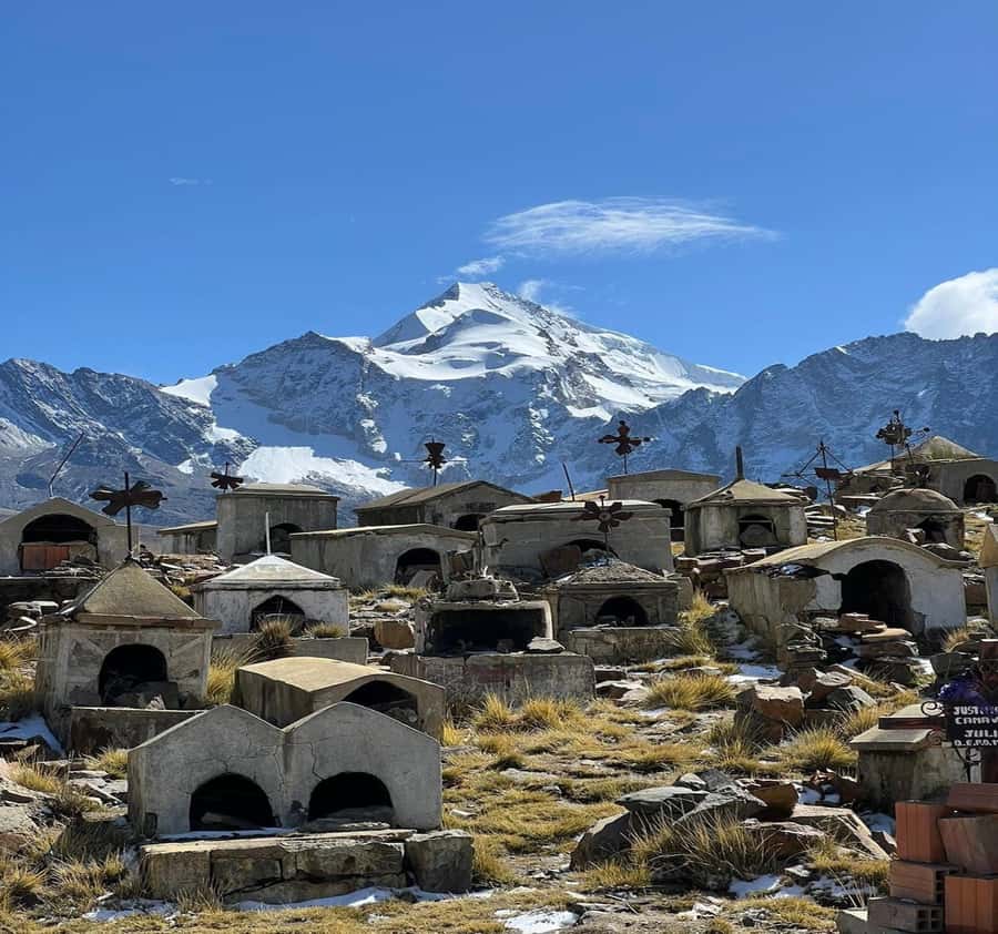
The route continues to the Cementerio de Milluni, a mining cemetery with a stark setting and a strong connection to the area’s mining past. The guide provides an explanation of the site, though the amount of detail can vary. Some guides give a useful account of the region, while others keep this stop brief.
That is one reason the guide can shape the day. Manuel, Paty, Juan, Marcos, and Adriano have all been singled out for being patient, friendly, or informative. You may not get the same person, but the tour is offered in English and Spanish, and a good guide can add much more than directions on the trail.
Next comes Laguna Milluni, where you can stop for views, photos, and a short explanation of the area. The lake and surrounding slopes show the spare beauty of the altiplano: little vegetation, wide skies, mineral colors, and mountains shaped by ice and weather.
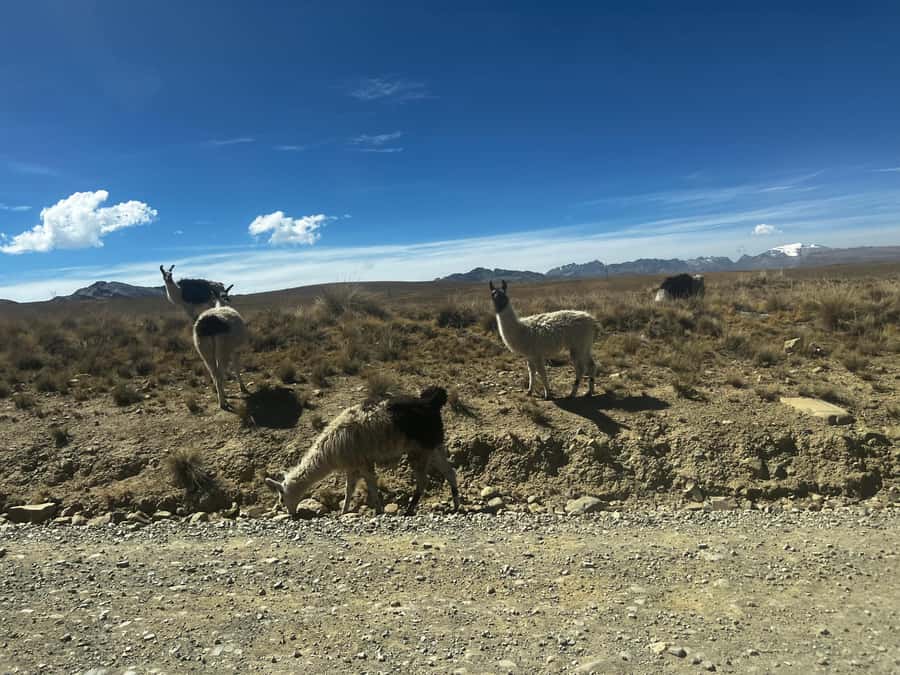
You may also spot llamas, alpacas, and Andean birds along the route. One outing included Andean geese, described as large white birds. These small sightings help keep the drive from feeling like mere transport.
More Guided Day Hikes in the world:
- From Marrakech: Ouzoud Waterfalls Guided Hike and Boat Trip
★ 4.7 · 33,630 reviews - From Marrakech: Atlas Mountains Full-Day Hiking Trip w Lunch
★ 4.8 · 7,417 reviews - Mount Etna: Summit Guided Hiking Tour up to 3,400 m
★ 4.8 · 4,792 reviews - Marrakech: ourika valley lunch & guided hike to waterfalls
★ 4.9 · 3,737 reviews
The Charquini hike from 4,600 meters
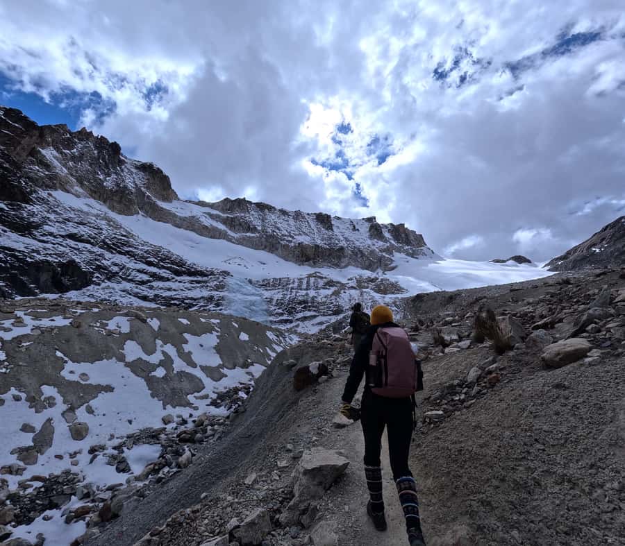
At the Charquini area, the real work begins. The trail starts around 4,600 meters and climbs toward the lake at roughly 5,024 meters. That is an altitude gain of about 424 meters, but the number does not tell the full story. At this height, your lungs are doing far more work than they would on a similar climb at sea level.
The uphill section can take about 45 minutes for a strong, acclimatized walker. Many people take 1 to 1.5 hours, and some need closer to two hours. Guides generally allow the group to set its pace, stopping when needed and staying near the slowest walkers.
This is where the walking sticks help. They are eco-friendly and included in the price, and they can make the uneven or steep sections easier on your knees. Wear proper shoes, not casual sneakers with smooth soles.
The path is not described as a technical climb, and there are no lifts or elevators. You walk the entire way. The main difficulty comes from altitude, not complicated scrambling. Still, cold, wind, wet ground, or snow can make it feel tougher.
If you begin to feel unwell, tell the guide immediately. Headache, unusual breathlessness, dizziness, nausea, or weakness should not be treated as a challenge to push through. Emergency oxygen is carried on the tour, but it is a safety measure, not a substitute for acclimatization or medical judgment.
Arriving at Laguna Esmeralda
At the top, Laguna Esmeralda gives the hike a clear reward. The water can look green or emerald rather than the bright blue shown in some photographs. Its color changes with light, minerals, ice, weather, and the angle of the surrounding slopes.
The setting is more impressive than the lake alone. Charquini’s rough mountain walls, glacier remnants, snowfields, and open sky create a stark Andean scene. On a clear day, this is the place for the best photographs. Guides often help with camera angles and take pictures for the group.
Allow time to sit, catch your breath, and eat your snack. The included food has varied, with fruit, cookies, chocolate, bananas, empanadas, or a small sandwich reported on different trips. It is a helpful extra, but bring your own food and water as well.
Do not assume the lake will look the same in every season. From June to August, it may be partly frozen. During the rainy season, the trail can be wet. Snow and hail are possible even when the drive begins in sunshine.
One practical point deserves attention: you are spending time above 5,000 meters. The group may stay at the lake for photographs and rest, sometimes around 45 minutes. If you are sensitive to altitude, do not let the excitement of photos override how you feel. Tell the guide if you need to descend.
The walk back and return to La Paz
The return follows the same general route back to the vehicle. Downhill time is often around 30 to 60 minutes, though the group may move more slowly on loose or wet ground.
Once back in the vehicle, the group returns toward La Paz, with the drive taking roughly 45 minutes from the trail area. The road may feel rough after the hike, and mountain weather can worsen during the afternoon. One driver advised taking photos early because conditions had deteriorated by the return journey. That is sound advice: use clear weather when you have it.
The tour may return around 3:30 p.m., though earlier arrivals are common. That makes this a useful choice if you want a major mountain outing without giving up the entire evening.
What the $39 price covers
At $39 per person, this is a good-value day trip if you want a guided introduction to Bolivia’s high Andes. The price includes round-trip transport, a live guide in English or Spanish, a small snack, walking sticks, and emergency oxygen.
The small-group limit is 15 people. Groups may be smaller, sometimes only two or a handful of walkers. A small group makes it easier for the guide to adjust the pace and help with photos, though group size can vary from day to day.
You should carry cash for the entrance fee. The activity information lists Bs20, while some people have paid Bs10 at the Charquini entrance. Since the amount may vary, bring enough small bolivianos rather than relying on the listed figure alone. Toilets may also cost a small amount, and local stops sell coca tea, gloves, fruit, and other basic items.
At the current price, the value is strongest if you would otherwise need to arrange a private vehicle and guide. It is less compelling if you are expecting a long hiking day. The walk itself is relatively short, and much of the eight-hour outing is transport and sightseeing stops.
Clothing, food, and altitude preparation
Pack for a cold, exposed mountain, not a mild city day. You need comfortable hiking shoes, a warm jacket, hat, gloves, and layers. Sunglasses and sunscreen are also sensible because the sun can be strong at high altitude, even through thin cloud.
Bring water and extra food. The snack is welcome, but it is not meant to replace lunch. Keep cash handy for the entrance fee, toilets, tea, and small purchases.
Most important, allow time to adjust to La Paz before booking this hike. The tour is not suitable for people with altitude sickness, respiratory problems, heart problems, high blood pressure, or a recent cold. It is also unsuitable for pregnant people, wheelchair users, people with back problems, and people afraid of heights. The stated guidance excludes people over 70, and people over 95 are specifically listed as unsuitable.
The tour operates rain or shine. That does not mean the views will be good in every weather condition. A clear day can produce spectacular mountain photographs, while a snowy or cloudy day may turn the experience into a quiet, moody walk with limited distant views.
Who should book this Charquini outing?
I would choose this tour if you have limited time in La Paz, want a taste of high-altitude hiking, or need a shorter test before considering a longer trek. It suits reasonably active people who are already acclimatized and comfortable walking slowly uphill.
It is also a good fit for photographers. You get several viewpoints, a striking lake, changing weather, and guides who often help with pictures. The short trail leaves more time to look around than a demanding point-to-point trek.
I would not book it as your first activity after arriving in Bolivia. I would also avoid it if your main goal is a long day of hiking. The route is scenic and worthwhile, but the walking portion is usually closer to two hours than three.
Should you book it?
Book this Charquini trip if the combination of easy transport, big mountain scenery, and a short high-altitude hike sounds right for you. The price is fair, the route packs several sights into one day, and guides are generally praised for staying with slower walkers and keeping the group together.
Skip it if you are poorly acclimatized, need a guaranteed clear view, or want a serious full-day trek. For the right person, Laguna Esmeralda offers a memorable look at the Andes without the time and cost of a multi-day expedition. Just respect the altitude, bring warm layers, and expect Bolivia’s schedule to be flexible.
FAQ
How high does the Charquini hike go?
The hike starts at about 4,600 meters and reaches Laguna Esmeralda at approximately 5,024 meters. Nevado Charquini itself rises to about 5,390 meters, but this tour does not climb to the snow-capped summit.
How long is the hiking portion?
The uphill walk usually takes about 45 minutes to two hours, depending on your pace, the group, and conditions. The complete hiking stop is planned for about three hours, including time at the lake and the return to the vehicle.
What is included in the $39 price?
The price includes round-trip transport, an English- or Spanish-speaking guide, a small snack, eco-friendly walking sticks, and oxygen for emergencies. The entrance fee is not included.
Do I need to bring cash?
Yes. Bring cash in bolivianos for the entrance fee, which is listed as Bs20, though some people have paid Bs10. Small amounts may also be needed for toilets or purchases at local stops.
What should I wear and bring?
Bring comfortable hiking shoes, warm layers, a jacket, hat, gloves, water, food, sunscreen, sunglasses, a camera, and cash. Large bags, luggage, bikes, alcohol, drugs, baby carriages, and electric wheelchairs are not allowed.
Is the tour suitable for people with altitude or health problems?
No. The tour is not suitable for people with altitude sickness, respiratory issues, heart problems, high blood pressure, back problems, or a recent cold. It is also not suitable for pregnant people, wheelchair users, people afraid of heights, or people over 70 according to the stated restrictions.
Just added around the world
- Madeira: Hike Transfer to Ponta de São Lourenço (PR8)★ 4.8 · 26 reviews
- Garibaldi Park/ Panorama Ridge/ Hiking Day Trip★ 5.0 · 4 reviews
- Glacier Express Jeep & Hiking Tour – Local Icelandic Guide★ 5.0 · 8 reviews
- Full Day in Côte Bleue: Scenic Nature Walk and Boat Tour★ 5.0 · 3 reviews
- Funchal: Pico Grande Guided Hike with Curral das Freiras★ 5.0 · 6 reviews
- Funchal: PR1.2 Pico Ruivo & Achada Teixeira Hiking Transfer★ 4.9 · 27 reviews
- From El Calafate: El Chalten Full-Day Tour and Short Hike★ 4.5 · 84 reviews
- From Reykjavik: South Coast and Glacier Hiking Tour★ 5.0 · 14 reviews
Mountain & Summit Hikes, compared.
Sunrise Mount Batur Guided Hike with Breakfast
Read our review →
Mount Batur Sunrise Guided Hike and Natural Hot Spring
Read our review →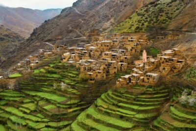
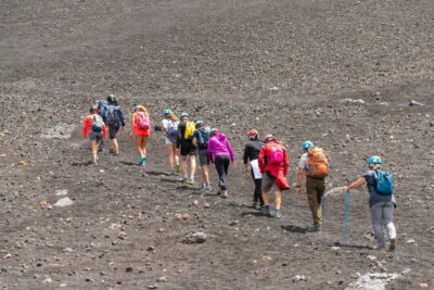
Mount Etna: Summit Guided Hiking Tour up to 3,400 m
Read our review →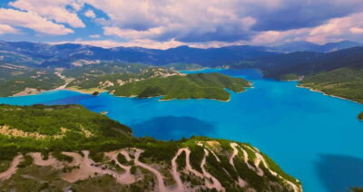
Bovilla Lake & Gamti Mountain Hiking Day Trip
Read our review →

Mount Batur Sunrise Hike and Natural Hot Spring Option
Read our review →Browse the lists this tour appears in